
Towering and formidable, Mount Index is perhaps the most awesome and fiercest sight and site along US 2. But softening its stark appearance is Bridal Veil Falls. Emanating from beneath the mountain's austere crags, the tiered and tumbling cataract drapes over granite slabs. To really appreciate this plummeting waterway, however, you'll need to leave your vehicle and hit the trail. And in your journey, discover a secret - there's a beautiful lake perched beneath those rugged spires feeding those falls.
Start by following an old road lined with mossy maples and alders. Cross a series of minor tributaries. Pretty in their own right, especially after a storm, these streaming streams are also eroding away chunks of tread. Next, along a thickly forested slope, the trail gradually ascends. At 1.7 miles, just after leaving the old roadbed, come to a signed junction (elev. 1200 ft.). The trail left continues on, heading to "secret" Lake Serene tucked in a deep basin beneath the spires of Mount Index.
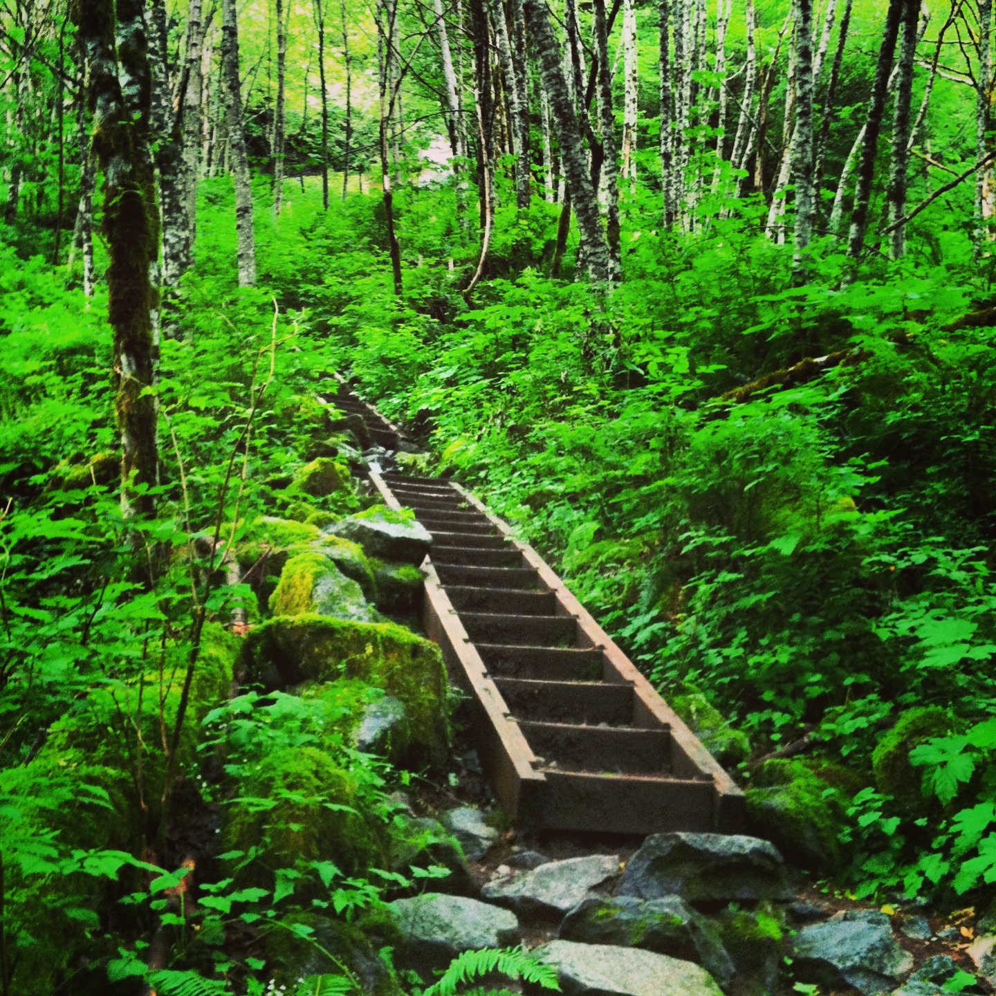
For Bridal Veil Falls, head right. The falls is 0.5 mile away. Just follow the roar, using a series of short switchbacks and stairways that steeply climb toward the tumult. Cross several side creeks and expect to get your feet wet. Be sure to pause for a moment or two to look back at the Skykomish Valley spread below. One last grunt and reach the first of two waterfall viewing platforms.
Except for late summer, when the falls trickle more than pummel, the roar should be pretty deafening at this point. Don your rain parka and set out on a drenched boardwalk to embrace the cascade's full force and beauty. Bridal veil? From this proximity, it's more like a bridal shower. Literally soak up the falls beauty. When you've had enough, retreat to the trail junction and make a decision. Back to your rig, or up to Lake Serene?
Serene usually wins, so carry on. Continue on the main trail, dropping a little into a damp ravine. Cross Bridal Veil Creek on a well-built bridge, and then begin climbing. On solid tread that occasionally utilizes stone steps and rock cribbing, the trail steeply ascends. A long sweep east - then a long sweep west - the way works under, over, and around cliffs, gaining 1300 feet in about 1.5 miles. Take in fine views of the valley below as well as out to Ragged Ridge and other peaks of the newly minted Wild Sky Wilderness.
And Lake Serene? It lies just a short distance ahead tucked in a tight basin beneath the ramparts and parapets of fortress Index. Stare straight up those 3000-vertical-foot stark walls. Hardly serene, it's more like awe-inspiring. But when the basin is calm, those imposing rock faces delicately reflect in the lake's surface. Now, that's serene and quite a sight!
Start by following an old road lined with mossy maples and alders. Cross a series of minor tributaries. Pretty in their own right, especially after a storm, these streaming streams are also eroding away chunks of tread. Next, along a thickly forested slope, the trail gradually ascends. At 1.7 miles, just after leaving the old roadbed, come to a signed junction (elev. 1200 ft.). The trail left continues on, heading to "secret" Lake Serene tucked in a deep basin beneath the spires of Mount Index.
For Bridal Veil Falls, head right. The falls is 0.5 mile away. Just follow the roar, using a series of short switchbacks and stairways that steeply climb toward the tumult. Cross several side creeks and expect to get your feet wet. Be sure to pause for a moment or two to look back at the Skykomish Valley spread below. One last grunt and reach the first of two waterfall viewing platforms.
Except for late summer, when the falls trickle more than pummel, the roar should be pretty deafening at this point. Don your rain parka and set out on a drenched boardwalk to embrace the cascade's full force and beauty. Bridal veil? From this proximity, it's more like a bridal shower. Literally soak up the falls beauty. When you've had enough, retreat to the trail junction and make a decision. Back to your rig, or up to Lake Serene?
Serene usually wins, so carry on. Continue on the main trail, dropping a little into a damp ravine. Cross Bridal Veil Creek on a well-built bridge, and then begin climbing. On solid tread that occasionally utilizes stone steps and rock cribbing, the trail steeply ascends. A long sweep east - then a long sweep west - the way works under, over, and around cliffs, gaining 1300 feet in about 1.5 miles. Take in fine views of the valley below as well as out to Ragged Ridge and other peaks of the newly minted Wild Sky Wilderness.
And Lake Serene? It lies just a short distance ahead tucked in a tight basin beneath the ramparts and parapets of fortress Index. Stare straight up those 3000-vertical-foot stark walls. Hardly serene, it's more like awe-inspiring. But when the basin is calm, those imposing rock faces delicately reflect in the lake's surface. Now, that's serene and quite a sight!


